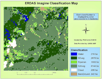
Week 5 of Remote Sensing covered the basics of ERDAS Imagine. For this module we were given an opportunity
to explore where some of the tools were located and how to use them. We also
used the viewer to view data in ERDAS Imagine. We then preprocessed an image for making a map
in ArcGIS. I am however a little leery because the lab instruction mentioned “crashes”
and using “work arounds” to make ERDAS Imagine work properly. But with that said, I was able to create the
map above without much problem. The map depicts
a sub-section of an image of forested area in Washington state which was
classified into different types of ground cover.

No comments:
Post a Comment